Warm Gulf Waters – Higher Severe Weather Risk?
4/18/2017 (Permalink)
More tornadoes?
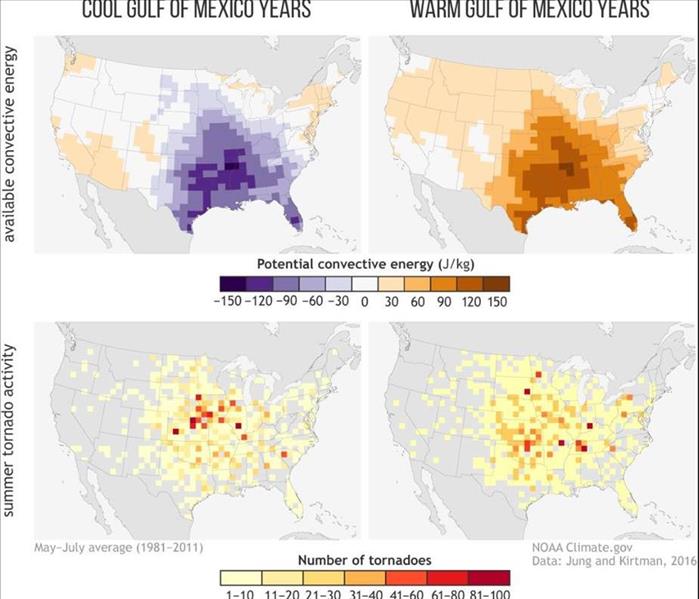
This winter, the average sea surface temperature of the Gulf of Mexico never fell below 73 degrees for the first time on record. Scientists have found that when the Gulf of Mexico tends to be warmer than normal, there is more energy for severe storms and tornadoes to form than when the Gulf is cooler.
One of the best predictors of storm activity is a variable known as convective available potential energy, or CAPE, which essentially measures the amount of energy available to rapidly lift a parcel vertically through the atmosphere. Values of 2,500 joules/kg are generally considered high enough to provide ample energy for severe storms to form.
A study published in the journal Geophysical Research Letters in December found that the warmer the Gulf of Mexico sea surface temperatures, the more hail and tornadoes occur during March through May over the southern U.S.
Hurricanes
The implications of the warm water for hurricane season are less clear. Warmer than normal water temperatures can make tropical storms and hurricanes more intense, but wind shear and atmospheric moisture levels often play more important roles in hurricane formation.


 24/7 Emergency Service
